About Bloor Homes
Bloor Homes is a family-owned private housebuilder with a reputation for quality, consistently achieving the highest five-star rating for customer satisfaction in the annual National Housebuilders Federation National New Homes Customer Satisfaction Survey. Over 97% of our customers would recommend us to family and friends.
Find out more at: https://bloorhomes.com/
The site
The 10.5ha site is located to the south of Sacheverell Way, Groby, and is identified as a location for future housing delivery in the Regulation 18 draft of the emerging new Hinckley and Bosworth Local Plan as site LPR146 A&B.
The northern boundary of the site is defined by the tree-lined hedgerow to Sacheverell Way, beyond which lies the established settlement edge of Groby. The site’s eastern boundary is defined by a public right of way (R116/2); beyond which lies an area of woodland and the A46. The site’s southern boundary is also defined by a public right of way (R51/3) and a tree group / individual trees, whilst its western boundary comprises a woodland block, and a dismantled railway (now used as a farm access track).
Blue line areas
To the immediate west of the site is 3.6ha of additional land that is also under the control of Bloor Homes. It is an area of grassland with linear tree corridors and sporadic, informal tree clusters. That part of the site is served by public right of way R51/3 (which also runs through the main part of the site), though an informal route through the grassland area appears to have formed. This area is a candidate Local Wildlife Site and will not be subject to any development. It will instead be set aside as a biodiversity area in recognition of its status as a potential Local Wildlife Site, with existing habitats retained and where possible enhanced.
Bloor Homes also controls additional land to the east of the A46 which is also shown within a blue line. This area has no access from the public highway and will also not be subject to any development.
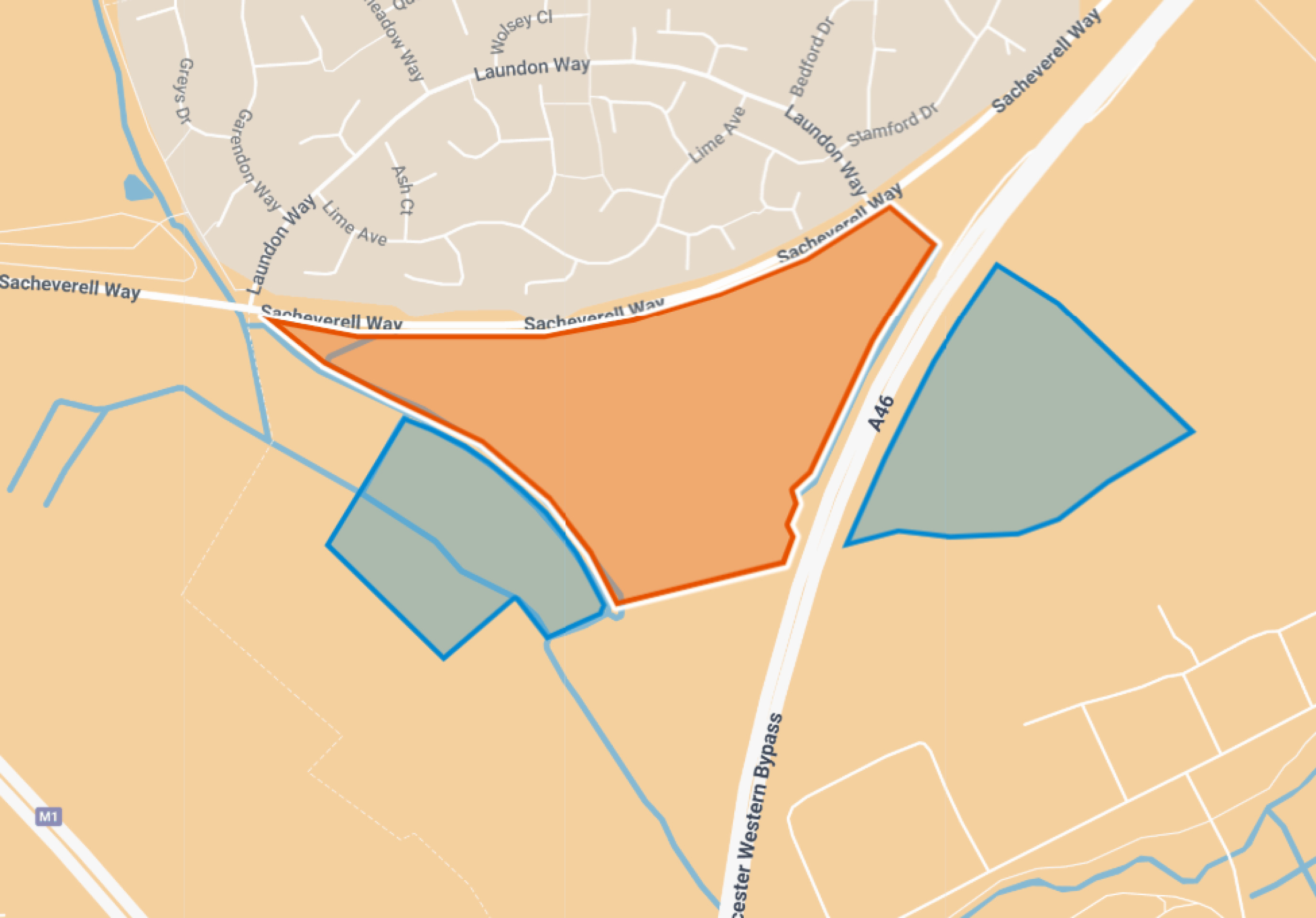
Site location plan - click to enlarge
Access to local services
The site is very well-connected to local services and facilities and is, therefore, a logical extension to Groby.
Groby is recognised within Hinckley and Bosworth Borough Council’s adopted and emerging Local Plans as being a “Key Rural Centre”, on Tier 2 of the Council’s settlement hierarchy. That reflects the range of services and facilities available within the village (as shown in the adjacent plan), and the high-level of connectivity that Groby has to other key settlements in the area.
The village contains a wide range of services and facilities. That includes a number of convenience stores, a post office, a doctor’s surgery, a pharmacy, a butcher, a dentist, places of worship, three primary schools, two pre-schools, an education learning campus (incorporating a high school and a community college), various parks including the Marina which has a BMX Track, Groby Community Centre and Groby Village Hall. The site is well-connected to those services and facilities; with residents able to access the village centre by a short walk / cycle journey, and also benefitting from key facilities closer to the site at Laundon Way, including a reasonably sized food shop with parcel lockers, a primary school, and areas of public open space.
Given the range of services and facilities on offer within the village, it acts as a rural centre for surrounding rural settlements including Ratby, Markfield, Newton Linford, Merry Lees, Stanton under Bardon, and Botcheston. Groby is, therefore, critical in supporting the day-to-day needs of residents in the wider area. Therefore, as recognised in national policy, residential development in this location will support the long-term viability of key services and facilities, and maintain the role that the settlement plays.
The site and village are also well-connected to other surrounding settlements via sustainable modes of transport. The 27 and 28 bus services run along Sacheverell Way, with stops on Laundon Way. Those services provide access to Leicester City, Glenfield, Ratby, Thornton, Ellistown and Coalville to the south and west; which have varying levels of services, facilities and employment opportunities that will be accessible to new residents of the site.
The 27 and 28 bus services provide access to the centre of Leicester (St Margaret’s bus station) in under 30 minutes. Therefore, residents of the site will be able to benefit from convenient, direct and sustainable access to the city and the full range of services, facilities and employment opportunities that are on offer therein.
To the south of Groby, Ratby provides a similar level of services and facilities, including a primary school, a GP, places of worship, shops, pubs, restaurants, bars, a skate area, parks, and a community garden. As above, it is accessible via existing bus services, but is also accessible via the existing public right of way network.
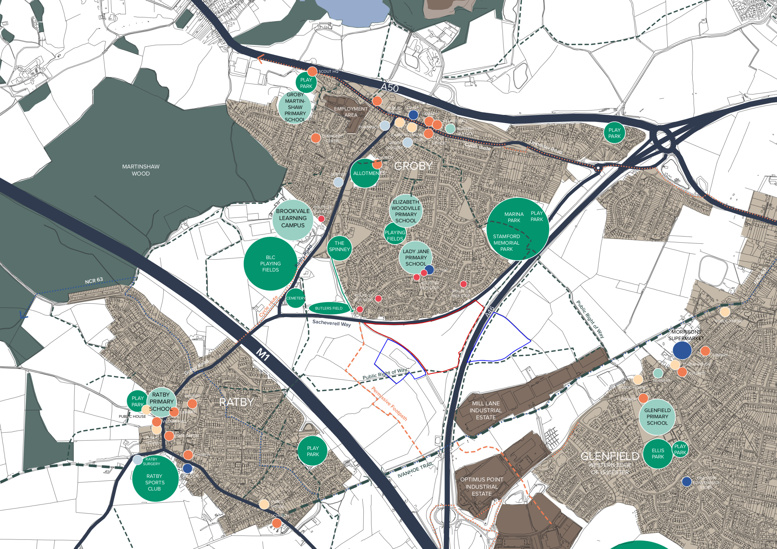
The site shown in the context of nearby services and facilities - click to enlarge
Planning policy context
Increased housing targets for Hinckley and Bosworth
In December 2024 the government published a new National Planning Policy Framework (NPPF). This has increased Hinckley and Bosworth Borough Council’s housing need figure and the number of homes that need to be delivered Borough from 432 homes per year to 649.
Five year housing land supply
The new NPPF also requires that local authorities like Hinckley and Bosworth Borough Council are able demonstrate a five-year housing land supply. This is the amount of land that the Council must identify to ensure there are sufficient deliverable sites for residential development over the next five years. Hinckley and Bosworth Borough Council cannot currently demonstrate this requirement.
Hinckley and Bosworth Local Plan
The extant local plan for Hinckley and Bosworth Borough Council comprises the Core Strategy, adopted in December 2009, and the Site Allocations and Development Management (SADM) Policies DPD, adopted in July 2016, both of which have fallen out of date.
The Council is now preparing a new Local Plan and has identified the site at Groby in the Regulation 18 draft of the new Plan as a non-strategic major development site to contribute to meeting the Borough’s housing need.
The new Local Plan is required to take account of recent changes to national planning policy, notably reflecting the Government’s clear policy objective to boost the delivery of housing in response to the national housing crisis, as set out above. In doing so, the Council has identified additional allocation sites including the proposed development site in Groby, to meet its housing needs in full in line with national policy.
Both the adopted and emerging local plan identify Groby as a Key Rural Centre on Tier 2 of the settlement hierarchy, reflecting the range of services and facilities available within the village. The Core Strategy seeks to support the Key Rural Centres to ensure that they will become, if they are not already, places where residents can fulfil their daily needs without having to travel long distances into urban areas.
Whilst the site is located outside of the limits to development as defined by the Core Strategy and SADM DPD, both documents are now out-of-date (having been adopted almost 16 and 9 years ago, respectively). This, along with the lack of a five year housing land supply, means that the Council has had to identify additional sites to meet its housing needs in the new Local Plan, including the site at Groby. Directing development to sustainable locations such as the site south of Sacheverell Way is an appropriate way of doing so, and an outline planning application is being prepared by Bloor Homes on this basis, in line with the draft allocation of the site in the new Local Plan. Preparing an outline planning application alongside the ongoing Local Plan process will enable housing delivery early in the Local Plan period.
The new NPPF has increased Hinckley & Bosworth Borough’s housing targets from 432 to 649 new homes per year
The site is identified as a draft allocation to contribute to meeting housing need in Hinckley & Bosworth Borough in the emerging new Local Plan
Green Wedge
It is recognised that the site is located within the Green Wedge. However, the Green Wedge designation is not a constraint to all development, and is intended to guide development to suitable sites in sustainable locations. Hinckley & Bosworth Borough Council has established a need to release land from the Green Wedge to meet development needs and have identified this site as being an appropriate location to do so, as when comparing the site to the Green Wedge objectives, it is clear that:
- The site does not contribute significantly to any of the Green Wedge objectives.
- The site’s location and the robust landscape framework in the surrounding area mean that any physical / perceived merging between Groby and Ratby can be limited by careful consideration of the built form and delivery of a robust landscape strategy.
- The scale of the Green Wedge being lost would be minimal, and the release of a site that is not currently publicly accessible (aside from the footpaths at its margins) would actually increase the site’s role as a recreational resource. The development would provide a significant element of enhanced multi-functional green infrastructure that can be retained in perpetuity to complement the residual Green Wedge within its immediate surrounds.
Therefore, the release of the site from the Green Wedge would be consistent with the objectives of the designation, while delivering much-needed development in a sustainable manner. The planning application will be accompanied by a Green Wedge Analysis Report that will consider the above matters in further detail.
An outline planning application establishes the broad principles of development, such as access arrangements, illustrative concept layout, number of homes and general extent of development.
If outline planning consent is granted, a detailed planning application called a Reserved Matters planning application would be prepared. This would include more detail such as architecture, materials, detailed layout and landscaping, and would be subject to further consultation with the local community before being submitted for determination. Both outline and Reserved Matters planning applications are subject to Statutory Consultation carried out by the Local Planning Authority (Hinckley and Bosworth Borough Council).
Site constraints and opportunities
How local features and landscape have shaped our thinking for the proposed layout of the new neighbourhood.
In preparing the concept layout for the site, the technical team appointed by Bloor Homes first of all considered the landscape, biodiversity features, topography, drainage regime, existing utilities infrastructure and local context of the site. The adjacent plan shows some of the features and constraints that have informed the emerging outline proposals.
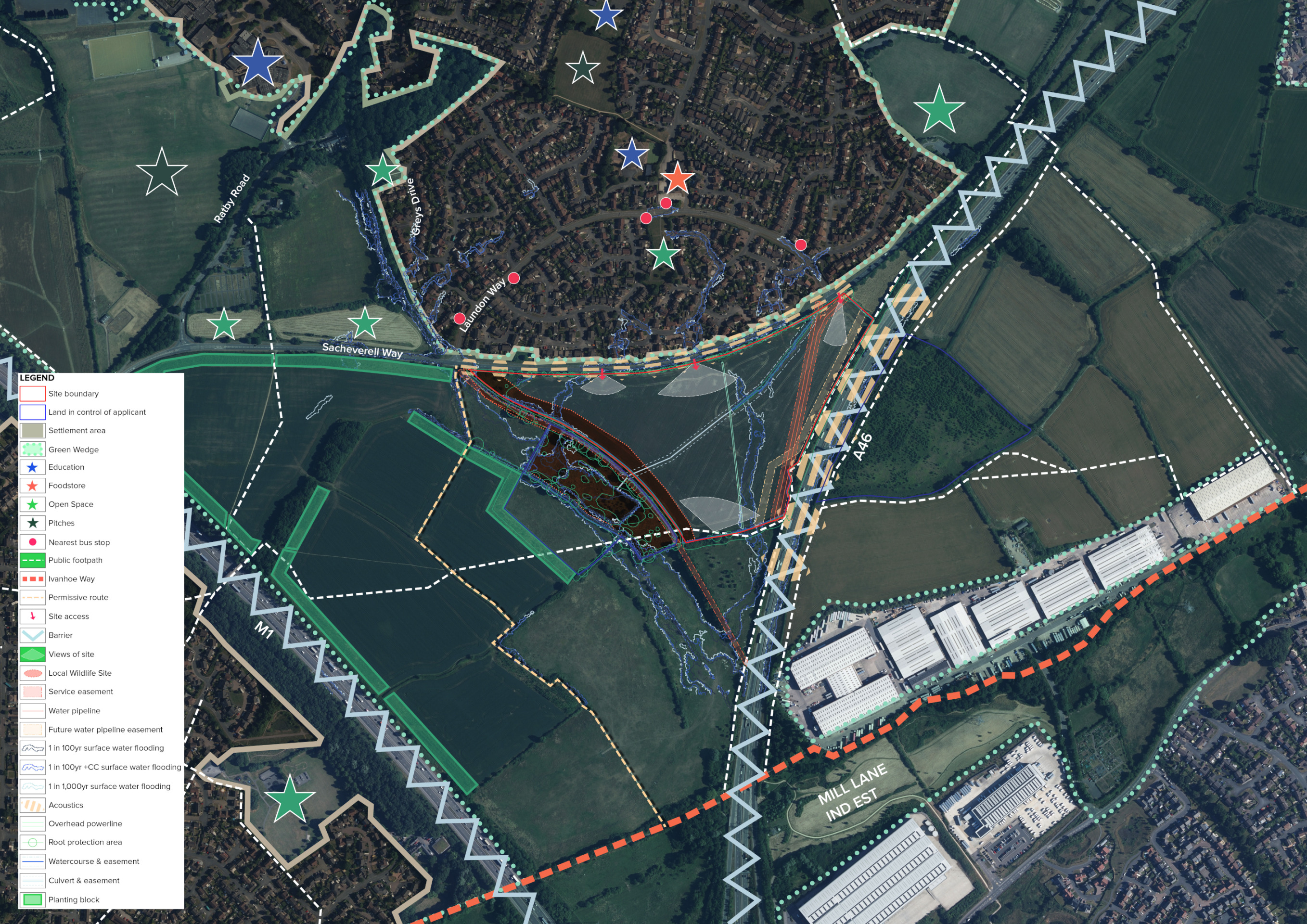
This plan shows an early analysis of some of the site features that have influenced the evolving masterplan for the site - click to enlarge
The emerging proposals for new homes and green open spaces
Bloor Homes is preparing an outline planning application for sensitive and sustainable residential development at the site south of Sacheverell Way, which would provide:
- Up to 180 high-quality homes in a range of sizes, type and tenures.
- Affordable housing providing opportunities for those on lower incomes to secure a home in Groby.
- The potential to provide accessible homes or bungalows as part of the housing mix.
- Safe and convenient vehicular, cycle and pedestrian access via two junctions with Sacheverell Way.
- Extensive green public open spaces, including green corridors and a network of walking routes connecting with existing public rights of way.
- Community orchard.
- Dedicated biodiversity areas provided as part of the development.
- Public common with play area.
- Sustainable Drainage scheme (SuDS) delivering habitat enhancements.
- Retention of existing mature trees and majority of hedgerows, with additional planting significantly increasing tree cover across the site.
- Significant financial contributions to invest in local infrastructure such as healthcare, education etc.
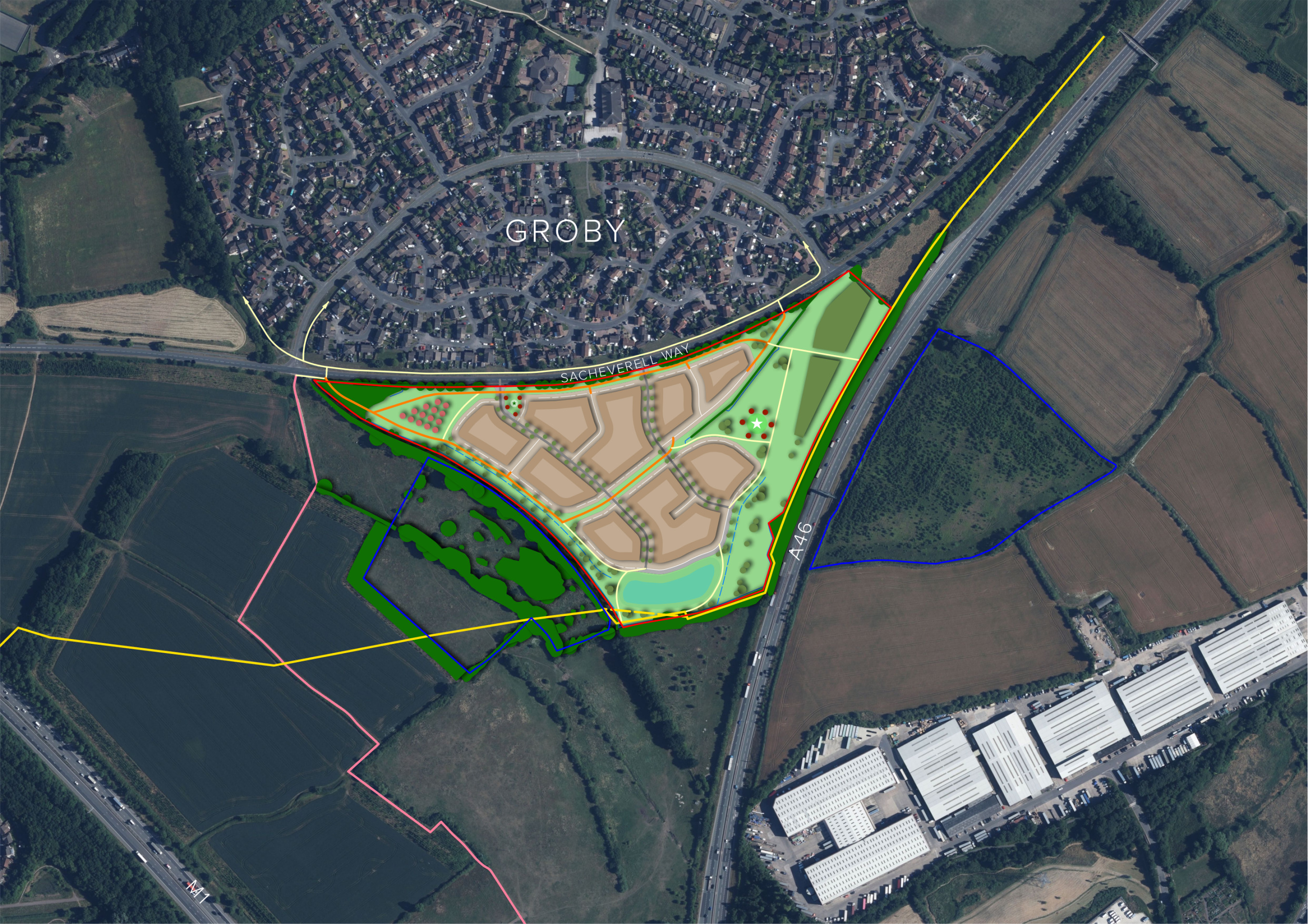
Illustrative outline layout of the proposed new neighbourhood – click to open view the proposals on our interactive map
Homes and community facilities
House types
The planning application is an outline planning application. This type of planning application sets out the broad principles of development, such as maximum number of homes, an illustrative layout and site access arrangements. Should outline planning permission be received, finer details such as specific house types, detailed layout, architecture etc would be subject to a subsequent further planning application (called a Reserved Matters planning application). This would involve further consultation with the community.
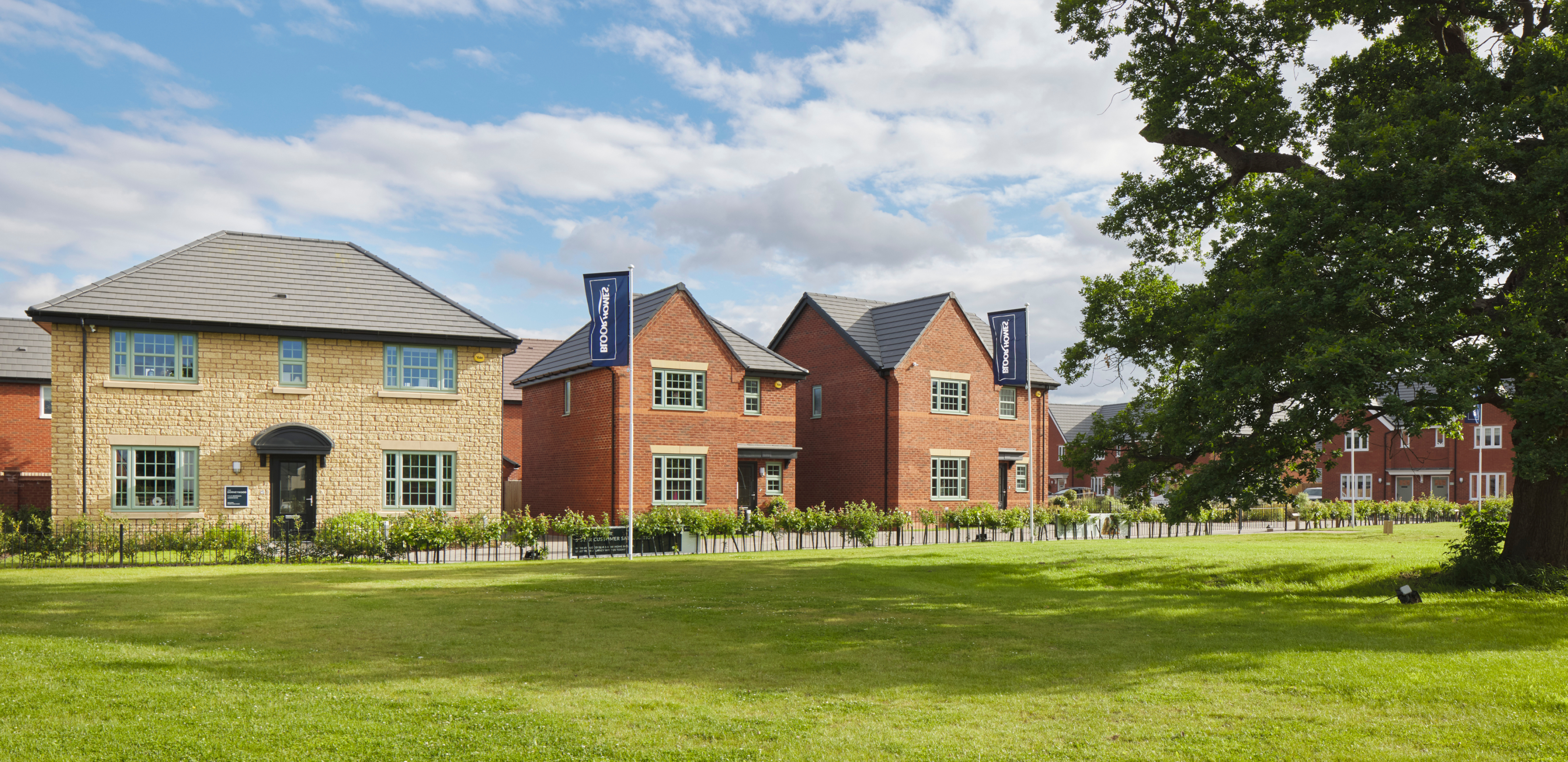
While house types would be determined at the Reserved Matters planning stage, we have provided imagery of existing Bloor Homes developments to provide an idea of the types of high-quality homes we build.
Use the feedback questionnaire to tell us the types of homes you would like to see prioritised in Groby.
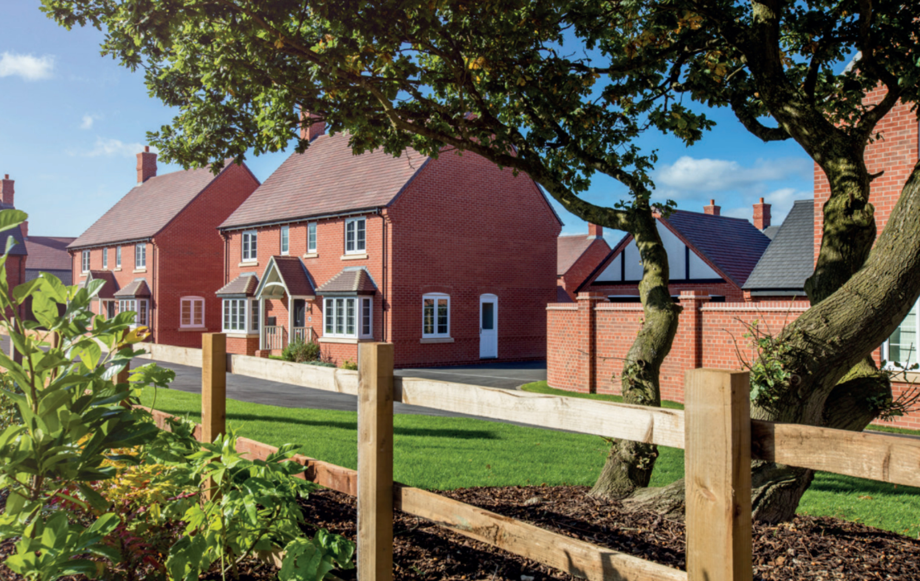
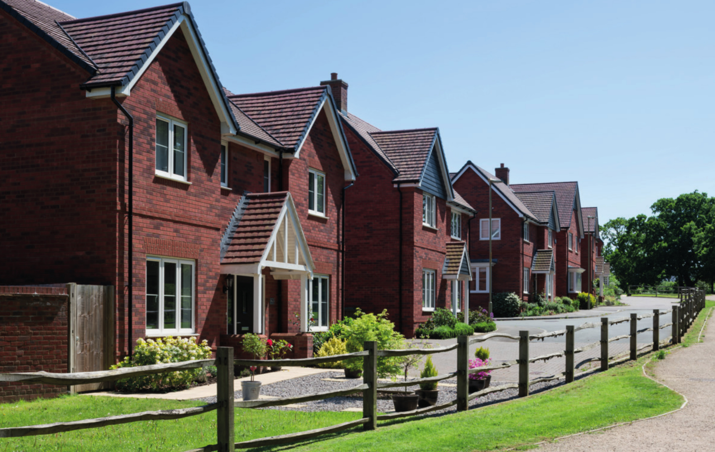
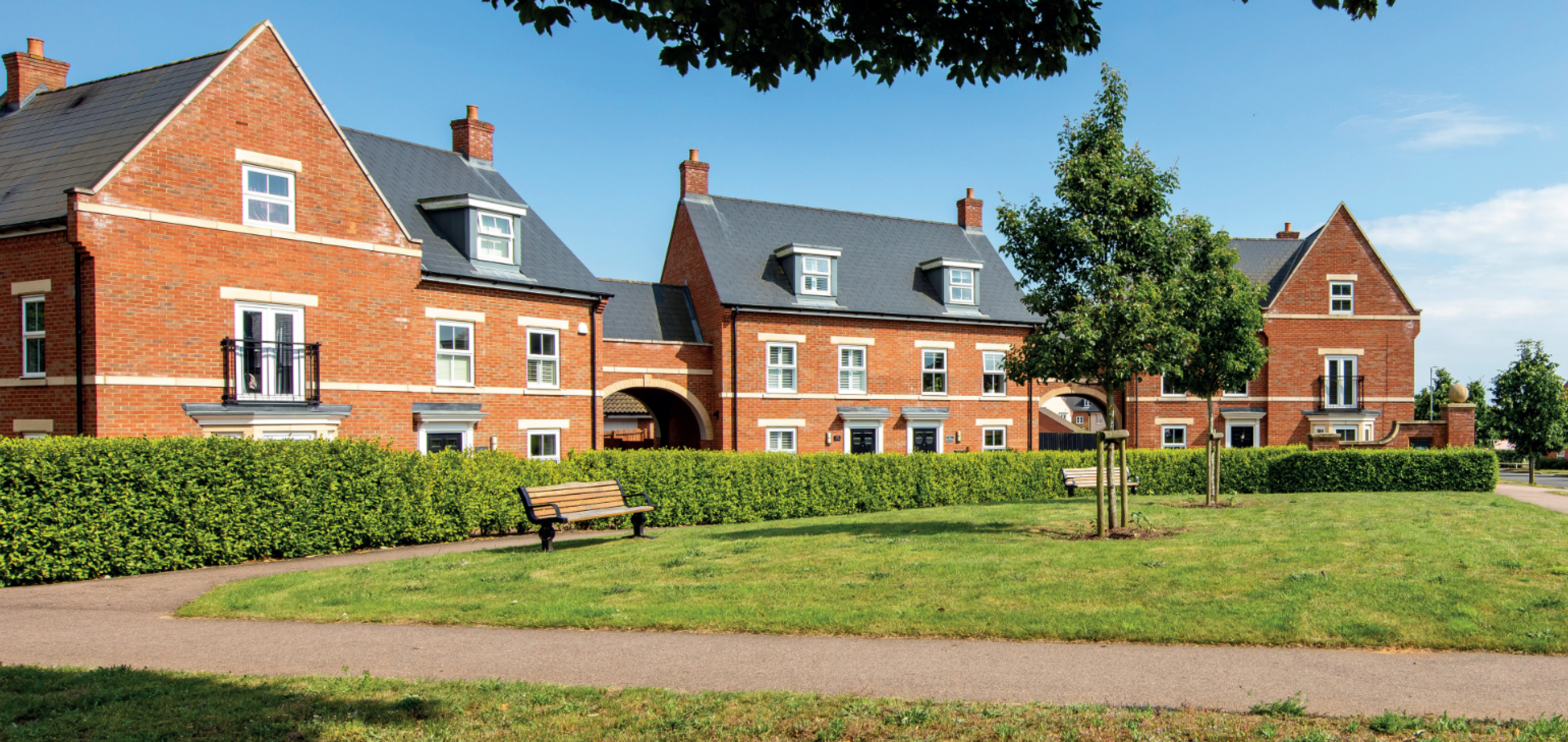
Examples of some recent Bloor Homes developments. Click to open a gallery of images.
Affordable housing
Affordable housing will provide opportunities for those on lower incomes with connections to the local area to secure a home of their own. Affordable housing is anticipated to be provided in a mix of affordable rent and shared ownership homes, however this will be determined in consultation with Hinckley and Bosworth Borough Council’s Housing Team.
We are happy to work with the Borough Council to explore the potential for Local Occupancy Criteria to be applied to the affordable housing provision, ensuring that it is prioritised for people with local connections.
Sustainable homes
We want to deliver homes that are sustainable now and contribute to a cleaner, greener future.
We know that sustainability is hugely important to communities across the country. The new neighbourhood at Groby will be gas-free, with all homes provided with air source heat pumps as standard. PV cells (solar panels) will also be incorporated, which along with the use of the latest materials and technique to maximise insultation, air tightness and heat recovery, will create an uplift in energy efficiency of 75-80%.
The new homes will incorporate sanitaryware and appliances that meet the highest water efficiency standards.
Electric vehicle (EV) charging points will be provided for all homes with on plot parking, together with access to communal EV charging points for the whole neighbourhood.
To minimise the impact of construction, Bloor Homes always aims to procure materials from sustainable sources and recycle construction waste as far as is possible.

All homes will include air source heat pumps, solar panels and EV charging points as standard
Investing in wider community infrastructure
A key consideration with a planning proposal such as this is to ensure that local services receive the investment they need to accommodate housing growth in the local area. The development will generate investment into local infrastructure such as healthcare and education, and this will be informed by consultation carried out by Hinckley and Bosworth Borough Council with statutory bodies such as the local NHS Integrated Care Board and the local education authority and will be secured via legal agreement between Bloor Homes and the Council.

The development will generate significant funding for key infrastructure such as healthcare and education, to be determined in consultation with bodies such as the NHS, local education authority, etc
Access and highways
Vehicular, pedestrian and cycle access will be provided via two new accesses from Sacheverell Way. The site access locations will ensure that residents can travel north to the facilities on Laundon Way (including existing bus stops) or travel west / north-west towards the centre of Groby / Ratby as required. The detailed access proposals that will be submitted alongside the application will take account of Leicestershire County Council guidance.
The proposed development will also provide links to the existing public rights of way / permissive routes close to the site. By delivering footpaths within the site, which would be publicly accessible post-development, residents of the site (and Groby more widely) would be able to access footpath R51/3 more directly, which provides access towards Ratby. Likewise, residents would be able to walk / cycle through the site to connect to R116/1, and then travel beneath the A46 using the Ivanhoe Trail; accessing the remainder of the Ivanhoe Trail, the employment area to the east of the A46, and Glenfield.
The planning application will be accompanied by a robust Transport Assessment that has been scoped with Leicestershire County Highways and will assess highway safety and capacity of the surrounding highway network to ensure that the development can be safely accommodated.
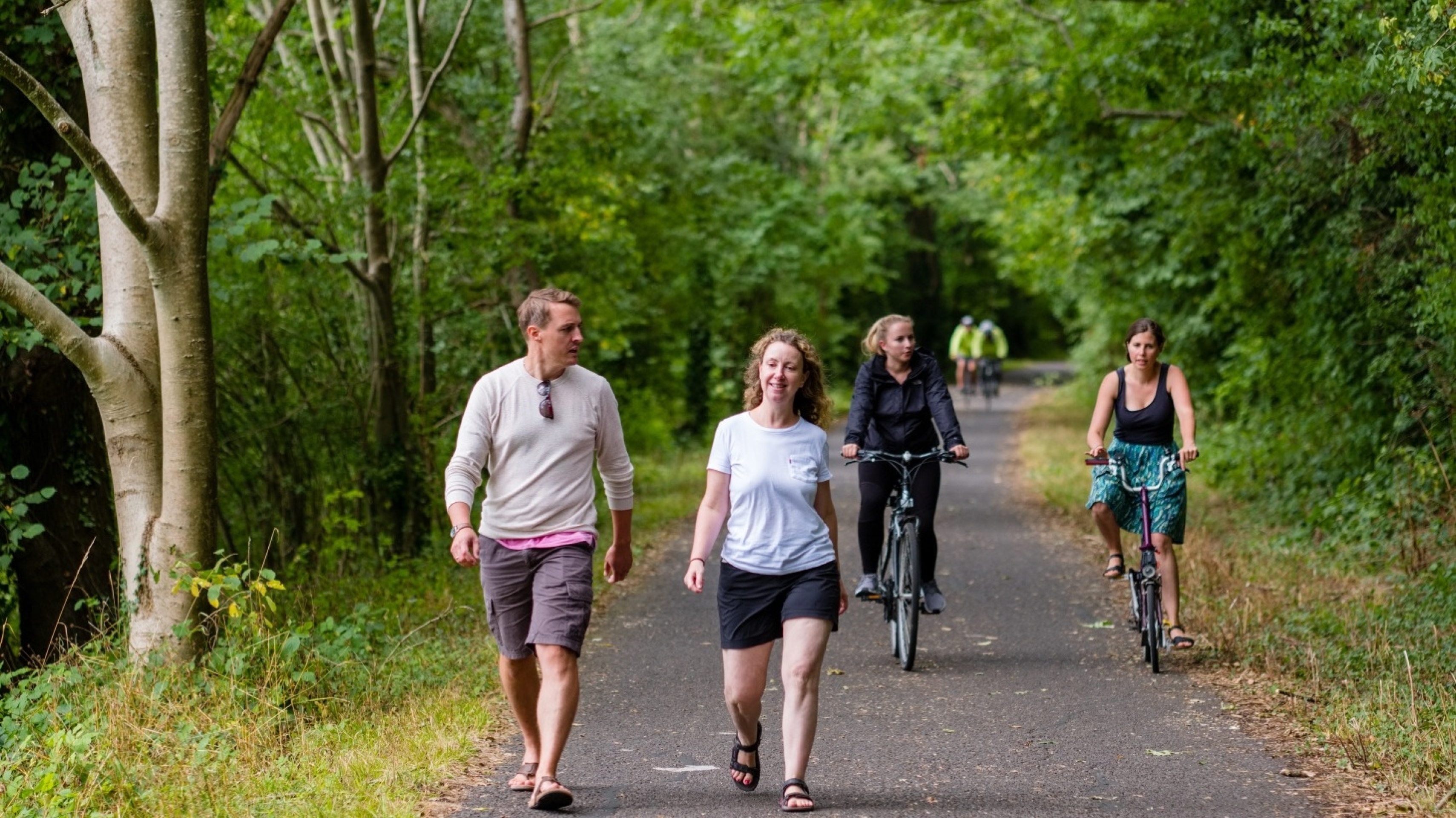
Public rights of way and permissive paths will be retained and enhanced within the site, connecting with a network of new walking and cycling routes provided within the development - click to enlarge
Green infrastructure and ecology
We want to ensure that natural habitats are protected while we deliver new homes for people and families.
We are conscious of the ever-increasing importance of ensuring that development is sustainable, protecting and enhancing natural habitats and green infrastructure as much as possible whilst delivering much needed homes for people and families.
Alongside the delivery of much needed high-quality new homes, the proposed development will also see a significant proportion of the overall site area retained as open space, including green corridors providing public recreational opportunities and areas for biodiversity enhancement.
Existing mature trees and the majority of hedgerows will be retained as part of the open space proposals with development parcels shaped by existing field patterns, and these will be enhanced with extensive additional planting. This will significantly increase tree cover across the site.
There are no statutory ecological designations within or adjacent to the site. The “blue line” land to the south-west is a candidate Local Wildlife Site, and will not be subject to any development. It will instead be set aside as an area for biodiversity enhancement in recognition of its status as a potential LWS, with existing grassland and trees retained, alongside habitat enhancements where possible.
There is also a “blue line” area to the south-east of the site on the opposite side of the A46. This land has no access from the public highway and no development will take place here, with existing trees and grassland retained.
Ecological assessments of the site are ongoing, including species surveys, and will be reported within the Ecological Appraisal that will accompany the application. That report will set out recommendations for the site’s development, including measures to protect ecology during the construction process.
The site is currently largely comprised of improved agricultural land, which is of relatively low value in terms of biodiversity. The retention of existing trees and the majority of hedgerows, along with the planting of new trees and other plants and the use of sustainable drainage features to create new wetland features, will create new habitats. This will significantly boost the biodiversity value of the site, delivering a minimum of 10% Biodiversity Net Gain (BNG).
A network of walking and cycling routes will be set within the proposed green corridors which will also provide a range of open space community facilities such as a play area and a community orchard.

Homes for Nature
Bloor Homes is a member of the Homes for Nature programme. This includes a commitment to see a bird-nesting brick or box installed for every new home built, as well as hedgehog highways as standard on every new development.

Drainage
The Environment Agency’s Flood Map for Planning confirms that the whole site is located within flood zone 1 and is therefore at the lowest risk of flooding from rivers or streams. However, there are areas of surface water flooding within the site which will be taken into account as part of a drainage strategy for the site.
A sustainable drainage system (SuDS) will attenuate surface water runoff from the new neighbourhood, ensuring that surface water discharge rates do not exceed existing levels and where possible provide betterment over the existing surface water drainage on the site and in the surrounding area. That will include localised topographical changes to channel surface water towards a drainage basin at the south of the site. The proposed attenuation area will also deliver biodiversity benefits through the provision of additional wetland habitat.
The sustainable drainage system for the new neighbourhood will also provide biodiversity benefits through the provision of wetland habitat.
Other technical considerations
Landscape and Visual Impacts
The site is not subject to a national landscape designation. The site’s robust vegetated boundaries to the east, west and south mean that the site is well-contained; and would not visually encroach into the wider landscape. It would be a logical extension to Groby, and would be viewed in the context of the existing built form.
A Landscape and Visual Impact Assessment has been undertaken, and has informed the evolution of the Masterplan. It finds that, given the proximity of existing footpaths, there will be inevitable impacts on the existing views from those locations, but that impacts on more distant views will be less significant; particularly after 15 years once the proposed planting will have reached maturity.
Heritage
There are no designated heritage assets within or in close proximity to the site. An archaeological assessment will be submitted alongside the planning application, and will consider the archaeological potential of the site.
Noise
The potential noise impacts from the A46 and Sacheverell Way have been carefully considered to ensure that the amenity of new residents will not be adversely impacted. That has influenced the location and form of the built development, which will provide appropriate mitigation.
Utilities
Existing utilities within the site have been accommodated within the emerging Masterplan, to ensure that they are not disrupted.
Next steps
Once you have had an opportunity to review the information above, and view the interactive concept masterplan, please take a moment to complete our feedback questionnaire. Please ensure that all feedback is submitted by Sunday 30th November so that it can be considered as an outline planning application is finalised.
It is envisaged that the outline planning application will be submitted to Hinckley and Bosworth Borough Council during the winter of 2025/2026. If you would like to receive email notification of the planning submission, please ensure you opt-in to receive email updates when completing the feedback questionnaire.